
Sources for Hays Neighbors
Public records describe a Hays block in layers. Parcel maps show lot geometry. Appraiser records identify owners and mailing details. Voter tools answer voter-facing questions, while local groups show civic ties. None is a full household roster.
| Source | What it shows on a block | Access |
|---|---|---|
| Ellis/Hays Geospatial Portal | Parcel, plat, road, boundary, and other mapped layers | Free viewer and downloads |
| Ellis Appraiser | Owner, situs, mailing, legal description, parcel ID | Free public portal |
| Voter records | Registration and polling context under Kansas rules | VoterView or supervised inspection |
| Hays civic directories | Organizations and adopted local places | Public organization pages |
| Local archives | Past names, addresses, maps, and directories | Library, society, and academic collections |
The owner of a Hays parcel may live elsewhere, and a mailing address may differ from its situs, or physical, address. Report that distinction before calling anyone a neighbor.
Mapping a Hays Neighbor Block
The Ellis County and City of Hays Geospatial Data Portal is the best starting layer for the immediate block. It exposes parcel, transportation, plat, boundary, polling-location, and downloadable map references.
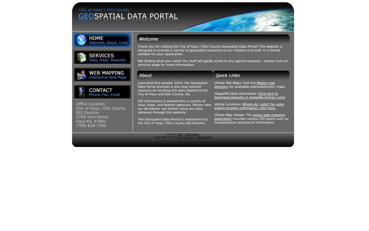
The portal view helps define which parcels are actually adjacent before any owner names are checked.
- Locate the subject street address and record its parcel ID, block, lot, and city-limit status.
- Click each parcel that touches it or faces it across the same short block segment.
- Open those parcel IDs one at a time in Ellis County Appraiser Public Access.
- Save the source date and label owner, mailing address, and situs address separately.
- Use a deed or archive only when a past-owner or historical-block question requires it.
Checking Hays Owners One by One
The Ellis County Appraiser portal accepts name, address, county ID, and section-township-range searches. A parcel result can provide the owner, mailing address, situs address, legal description, values, and improvements. It is an ownership and assessment record, not proof that the owner lives on the parcel.
Walking parcels one at a time is slower than compiling a broad list, but it keeps the inquiry tied to the actual block. For a full named-road method, use the Hays street directory instead of expanding the radius without a reason.
Lincoln Draw's Hays Block Label
The City of Hays Adopt-a-Spot participants page names “Lincoln Draw Neighborhood, 19th–27th.” That is a useful civic place label for research near the draw.
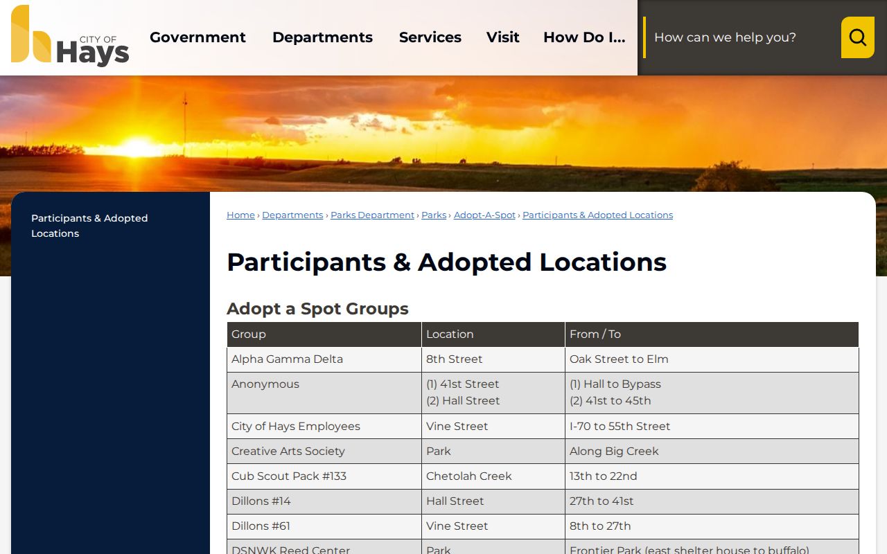
The listing does not prove a formal association, fixed legal boundary, or resident roster. Use it as local context and compare it with the dated map layer.
Hays Neighbor Community Directories
No official umbrella list of Hays neighborhood associations was located. The strongest public substitutes are civic and service-organization listings, city boards, Adopt-a-Spot participants, and named city places. They show affiliation and contact routes rather than homes.
Community organizations
Hays Chamber community-service directory
Local nonprofit, historical, arts, and civic contacts.
Service organizations
Hays Chamber service groups
Club and service-organization contacts.
Adopted locations
City Adopt-a-Spot list
Groups tied to named public places.
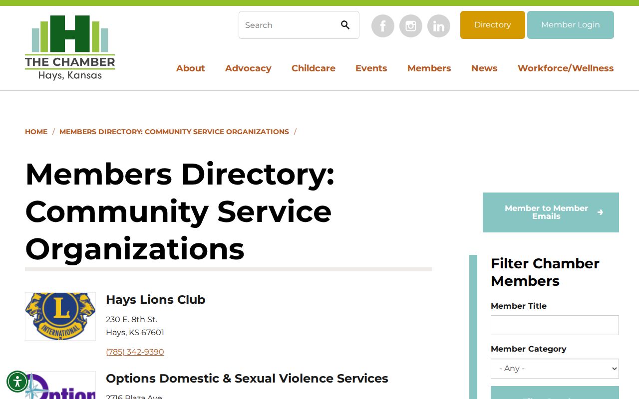
The directory supplies community contacts, not a complete list of Hays neighbors or members.
Compare the Hays service-organization directory shown below.
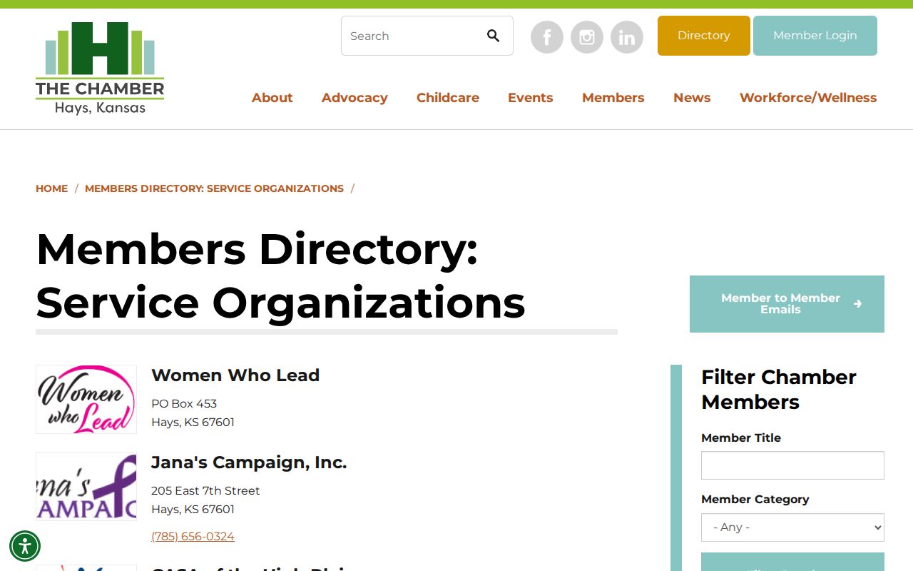
This second civic list can identify a public group contact, but it still provides no household or block roster.
Voter Context for Hays Neighbors
Kansas VoterView searches first name, last name, and date of birth for voter-facing status. It may return registration, address confirmation, party association, polling place, mail-ballot status, and county voting history. It does not offer an open block-radius search.
K.S.A. 25-2320 permits supervised inspection of active lists and a written-copy process through the election office. Protected identifiers are removed, and requests carry statutory limits. Precinct and polling geography may not follow the street, ZIP, or city-limit line, so retain the election date and boundary version.
Official Hays Rolls Versus Tools
Commercial neighbor tools may merge stale phone, marketing, and address data without showing when each field was collected. Official sources are narrower, but their custodian, date, and purpose are clear.
| Source type | Strength | Main limit |
|---|---|---|
| Parcel and appraisal roll | Authoritative parcel and owner fields | Owner is not always occupant |
| GIS map | Shows adjacency and legal geography | Layer dates and meanings vary |
| Voter record | Official voter status under Kansas law | Not a public household list |
| Commercial category | May combine many leads | Unclear freshness and weak context |
For civic curiosity or reconnecting with someone, use the smallest record set that answers the question and verify it with the keeper.
Past Hays Neighbors by Block
Hays Public Library, Ellis County Historical Society, and FHSU Special Collections preserve older block clues. ECHS lists telephone books and directories from 1931, Hays City building permits from 1921 through 1973, maps, atlases, obituaries, and court books. FHSU identifies Polk directories from 1963 through 2005 and 2006 to date.
Sanborn sheets and old maps can place a building but do not name occupants by themselves. One 2013 city legal description also calls Wilson Avenue “now 6th Street,” a warning to search both street labels. Cite the book year and page before describing past neighbors.
Hays Downtown Is Another Layer
The city's downtown Common Consumption Area is a regulated district with its own published boundary. It is not a neighborhood, parcel, ZIP, or postal route.
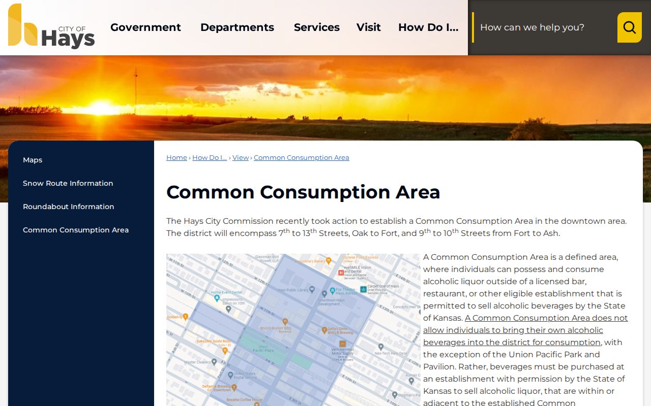
The boundary is a reminder that one address can sit within many civic layers, each made for a different purpose.
Privacy for Hays Neighbors
Kansas Safe at Home gives qualifying survivors a substitute legal address and mail forwarding. Do not try to reconstruct a protected location by joining parcel, voter, directory, or group results. A missing address may reflect privacy, a lag, a non-owner occupant, or the limits of the source.
Respect the block. Use Hays neighbor records for lawful personal research, never to stalk, harass, intimidate, or expose a protected person.
Correct an inaccurate public field through the agency that maintains it. Keep private notes to the minimum needed for a match, and omit dates of birth, private phone numbers, and substitute addresses.
Date Every Hays Neighbor Boundary
The July 2026 Hays city-limit and zoning maps provide a current snapshot, while parcel, precinct, postal, and civic boundaries follow their own update cycles. A line crossing a road can place facing lots in different legal areas even though they feel like one block. Record the map title and date beside any boundary claim.
ZIP 67601 is a mail-routing fact, not a neighborhood border. Lincoln Draw is a strong local place marker, but the Adopt-a-Spot wording does not create an incorporated association. Downtown's Common Consumption Area is a regulated district, not a resident roll. Precise labels keep the search useful without implying that all nearby households share the same civic status.
Archive Routes for Hays Neighbors
When a live parcel map cannot answer an older block question, take the address to the Hays Public Library Kansas Room, Ellis County Historical Society, or FHSU Special Collections. Ask for the target year, both current and old street names, the block or lot, and any family surname already supported by a source. Staff may route the request to directories, telephone books, newspapers, permits, yearbooks, maps, or obituary files.
The printed year matters. A directory shows a dated household clue, not continuous occupancy. A permit links work to a site, not every person there. An obituary may tie a family to Hays but not to the same block on every date. Pair each claim with its page, issue, or archive reference.
Reporting Hays Neighbor Results
Write the narrowest fact supported by the source: “parcel owner shown on the Appraiser card,” “organization listed in the Chamber directory,” or “name printed at the address in the 1963 directory.” Include the search date for a live portal and the publication year for a book. Avoid turning an ownership, voter, or civic record into a claim about an entire household.
If the records conflict, keep both dated facts and ask the custodian about the difference. If a protected address appears, stop the search. The goal is an accurate picture of a Hays block, not a dossier on the people around it.
For current contact, let the person or organization choose what it publishes. A civic directory email or office phone is not permission to disclose a private home address. That limit keeps the community layer useful while respecting Hays neighbors whose names appear only because they own land, vote, volunteer, or once appeared in an archive.