
Walk a Hays Street Directory Record Chain
Ownership is public through parcel and deed records, but ownership is not the same as occupancy. Begin with one complete address and build outward only as far as the question requires. Preserve the form printed on the source. Normalizing “West” to “W.” may help a current portal, but deleting the old spelling can break an archive search.
- Validate the street number, direction, name, suffix, unit, city, and ZIP with USPS.
- Search the Ellis Appraiser by property address and save the parcel ID, situs address, owner display, and legal description.
- Open the parcel area in ORKA or the Hays/Ellis GIS and note lots, blocks, roads, and boundary layers.
- Ask the Register of Deeds for instruments indexed to the owner or legal description.
- Use voter and directory records only within their stated access and date limits.
This street-by-street sequence creates an auditable chain: address to parcel, parcel to legal description, legal description to deed, then dated household evidence. A missing link should remain unresolved rather than being filled from a name match.
Search Hays Street Directory Parcels by Situs
The Ellis County Appraiser Public Access accepts owner name, property address, county ID, and section-township-range. Its parcel card can display owner and mailing information, the situs address, parcel ID, neighborhood, taxing unit, legal description, deed reference, valuation, improvements, and land or building facts. “Situs” means the physical parcel location, which can differ from the mailing address.
| Field | Type | Street-directory use |
|---|---|---|
| Owner/name | Text | Test surname and given-name variants |
| Property address | Number and street | Open one site on a Hays block |
| County ID/CAMA | Identifier | Preserve the exact parcel key |
| Section-township-range | Tract | Reach rural or legal geography |
| Update date | Display | Date the owner result |
View the official sample parcel card represented below.
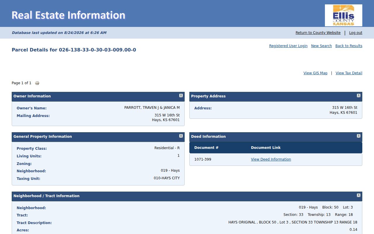
The card shows why the parcel ID and legal description are safer links than a street spelling alone.
Map Hays Street Directory Boundaries
The Ellis County and City of Hays Geospatial Data Portal, the Kansas ORKA viewer, and official Hays map pages add parcel, road, address, plat, transportation, lot, block, zoning, city-limit, and ETJ context. The reviewed viewer text did not verify a radius, select-all, or measure tool. Pan and zoom to a street segment, click parcels where supported, and open matching Appraiser cards one at a time.
Record each layer's name, date, and source. The city-limit map is dated July 8, 2026, and the zoning map July 7, 2026. A Hays postal address may sit outside incorporated Hays. An old parcel may also predate an annexation. Current city limits therefore cannot be projected backward without a map or ordinance from the target year.
Open the Ellis ORKA parcel-map source shown below.
The parcel viewer supplies geographic context; the Appraiser and deed record supply the named ownership evidence.
Hays Street Directory Records by Address
A Hays street directory result grows stronger when sources agree while still retaining their distinct meanings. The tax roll is an assessment lead. A deed is a recorded instrument. A permit may name an applicant or owner for work at one date. A directory entry can connect a listed subscriber or householder to a printed address, but it does not establish every person in the household.
| Record set | What it shows | Access |
|---|---|---|
| Ellis Appraiser | Owner, mailing/situs, parcel, legal description, improvements | Public name/address search |
| Ellis tax search | Taxpayer, tax ID, address, tract, due-status controls | Public portal |
| Hays/Ellis GIS | Parcels, roads, lots, blocks, zoning and boundaries | Public viewers and maps |
| Register of Deeds | Parties, instrument, date, legal description and plats | Office/index request |
| Planning and permits | Address, work, applicant or owner lead | Current city route; ECHS archive |
| Local directories | Dated name-to-address, sometimes address-to-name | HPL, ECHS and FHSU |
The tax portal also offers owner or taxpayer ID, name matching, street number and name, subdivision, block, lot, section, township, range, and lease name. Punctuation can change name results. Narrow a broad result and retain the search terms used.
Hays Street Directory Deed Requests
The Ellis County Register of Deeds records deeds, plats, mortgages, liens, leases, and other qualified instruments. It assigns recording time, book, and page information, then indexes documents by name and legal description. No official open grantor-grantee interface, sample result, or historical online cutoff was found. The Hays street directory must not pretend that the Appraiser card replaces that record.
Call 785-628-9450, visit 718 Main Street, or send a focused KORA request. Supply the current owner, likely prior party, date range, instrument type, parcel legal description, book and page, or instrument number. Ask about current copy and certification fees before ordering. If one deed names a grantor, search that person as the grantee in the earlier transfer to move backward.
- Plat
- A recorded map showing lots, blocks, additions, and related land divisions.
- Grantor
- The party conveying the recorded interest.
- Grantee
- The party receiving the interest.
- Criss-cross directory
- A printed directory arranged by address rather than only by surname.
Wilson Avenue Links to Hays Sixth
A city legal description from 2013 refers to “Wilson Avenue (now 6th Street)” in H.P. Wilson's Addition. It proves that the alias was recognized by then, but the exact renaming date and ordinance were not located. Historical searches should use Wilson Avenue, W. 6th Street, H.P. Wilson's Addition, and the legal block or lot.
This is an important street-directory safeguard. A modern geocoder may reject Wilson Avenue, while an early deed, newspaper, directory, or permit may never mention Sixth Street. The legal description and plat bridge those labels without guessing at the date of change.
Hays Street Directory Permit Ledgers
City planning pages link current building, mechanical, electrical, plumbing, roofing, right-of-way, sign, plat, lot split, rezoning, variance, appeal, and floodplain forms. They also point to an iWorQ route. The live search fields, sample permit card, exact coverage, and current public result schema were not captured, so do not promise an instant address search.
For older work, ECHS lists Hays City building permits from April 2, 1921 through December 20, 1973. Ask by street, number, year range, and owner or applicant. A permit can date work or connect a named party to an application. It does not establish residence.
Review the Hays permit and zoning route pictured below.
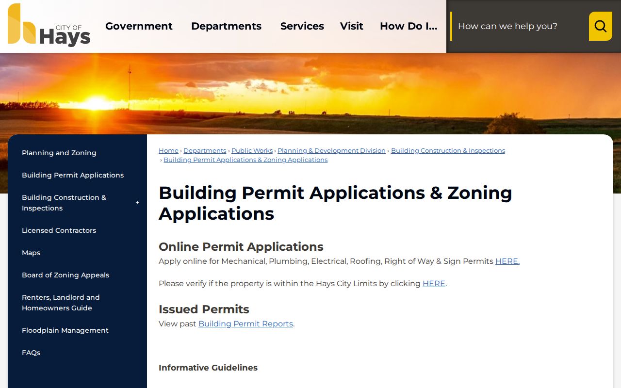
The city page identifies current request categories, while ECHS holds the documented historical permit run.
Hays Directories Date a Street
ECHS lists Hays telephone books and directories beginning in 1931. FHSU lists Polk Hays volumes from 1963 through 2005 and 2006 to date. Hays Public Library adds local directories, newspapers, yearbooks, maps, and microfilm. These are the proper fallback channels when current portals cannot answer who was associated with an address in an earlier year.
Ask whether a volume contains a reverse section arranged by street. Exact Hays criss-cross coverage was not located. When staff finds an entry, record the title, publication year, page, printed address, name, and every abbreviation. Telephone books omit unlisted numbers and may mix business lines or rural exchanges. For a full account of the volumes, use the Hays city directory collections.
Keep ZIP and Hays Limits Apart
USPS ZIP Lookup can validate a street address, city, state, and optional unit. It warns that an address result does not confirm a person or business at that address. The Hays Post Office at 706 Fort Street uses 67601, but postal geography and municipal geography have different purposes.
Keep the validated mailing form, then check the dated city-limit or ETJ map. For historical street work, also check annexation records and the boundary in force during the target year. The 2020 ordinance near 33rd and Sherman and the 2022 Heart of America area ordinance show why today's boundary cannot settle an older jurisdiction question.
Hays Recording Alerts Protect Owners
Ellis County posted its free Recording Notification Service on January 30, 2026. Participating owners can receive an alert when a document is recorded against a property. Signup requests name, address, telephone, and email. The service does not replace the deed index, does not look backward, and does not itself decide whether a filing is valid.
Use the alert after confirming the current parcel and recorded ownership. Keep the official notice, then contact the Register of Deeds about an unfamiliar instrument. This forward-looking tool complements the historical street directory chain.
Limits of a Hays Street Directory
No public source found in the research provides a complete list of every person living at each Hays address. The Appraiser shows parcel ownership, which may involve a different mailing address. VoterView is a voter-facing name and birth-date tool, not an address export. Public voter-list access follows K.S.A. 25-2320 procedures and prohibited-use certification. Utility customer lists were not located as a public directory.
Kansas Safe at Home uses substitute addresses and mail forwarding for qualifying survivors. Protected voter or address records can differ from ordinary public records. Do not infer that a missing person is absent from Hays, and never try to defeat a confidentiality program. State the result as owner, recorded party, voter-facing confirmation, or dated directory entry.
Lawful use. Use Hays street records for legitimate personal research; never stalk, harass, intimidate, or expose a protected person.